Find Your Tour
logo

Nepal Environmental Treks & Expedition (P.) Ltd.

Singu Chuli Peak Climbing

Singu Chuli Peak Climbing

Overview And Highlights Book This Trip

Key Information

Transportation:

Land Transportation/Flight

Group-Size:

1+

Altitude:

5,800 m

Singu Chuli (6,501 m) was formerly known as Fluted Peak. The first ascent of this peak was made by Wilf Noyce and David Cox on its North-East Face and the top section of the East Ridge.

Singu Chuli lies to the North of Tharpu Chuli along a connecting ridge. This mountain is a much stiffer proposition than Tharpu Chuli, and is the highest of all the trekking peaks in the area. There are no straight forward routes up the mountain. This trek is strongly recommended for excellent mountain views. You will enjoy the great cultural diversity in the Ghandruk-Chhomorong, Ghorepani. Before entering the Fish Tail (Machhapuchhare Base Camp) and Annapurna Base Camp, you can enjoy the panoramic views of the world’s highest mountains.

Itinerary Expand All Close All

Drive from Kathmandu to Pokhara (914m.) which takes about six hours.

You depart for the six hours drive to Pokhara (915m,), 200 kilometers west of Kathmandu . As you climb out of the Kathmandu valley, only to quickly descend again to the Trisuli River , you follow upstream to its junction with the Marsyangdi River . You follow the Marsyandi gently up through heavily terraced fields and small hill towns to the Seti River that takes you directly into Pokhara. Having pleasant weather, Pokhara is tourist’s paradise with full of natural as well as cultural heritage sites such as lakes, caves, temples of Buddhist and Hindus along with mountains. You can observe views to the north across the hills and Phewa Tal (lake) to the white peaks of the Annapurna and Dhaulagiri ranges. This drive will take most of the morning, leaving much of the afternoon to fall in love with its beauty.

Food
BLD
Accomodation
Hotel
Elevation
914

Trek from Pokhara (915 m.) to Nayapul (1050m.) by car, which takes approximately one and half hours drive. Now you begin your trek from Nayapul (1050m.) to Tirkhedhunga (1577 m.) via Birethanti (1065m.) which takes about four and half hours. After breakfast at hotel, you could drive for 1 and half hours to Nayapul. Then you start your trekking. The first part of your trek is easy passing through numerous small villages and settlements. Afterwards you could ascend gently to the final destination of the day. The majority people here are Gurung and their religion is Buddhist. They are engaged in agricultural activities, tourism business

Food
BLD
Accomodation
Lodge
Elevation
1050

Trek from Tirkhedhunga to Ghorepani (2675 m.) and it takes about six hours. To begin your trek, you could ascend steeply for the early 2 hours and then ascend gently passing through Ulleri (2070m.) and Banthanti, Magar villages. On the way, you could see good view of Machhapuchhare or Fish Tail (6997m.), Hiunchuli (6441m.), and Annapurna (7219m.) South. Now your trail is quite easier passing through rhododendron and shadowy trees and descends gently up to the final camp. You could see some of the wild life such as monkey and various species of birds.

Food
BLD
Accomodation
Lodge
Elevation
2675

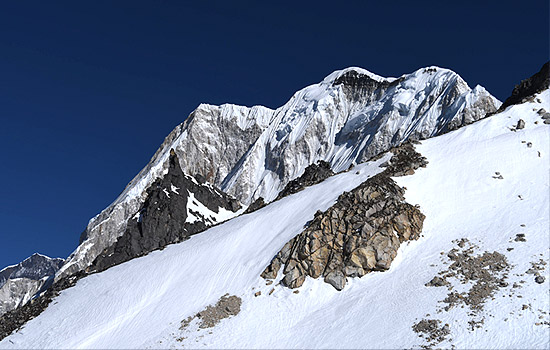
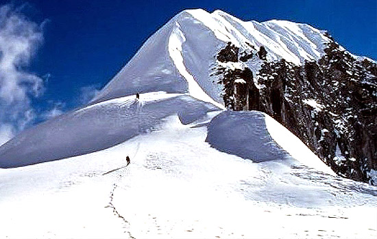
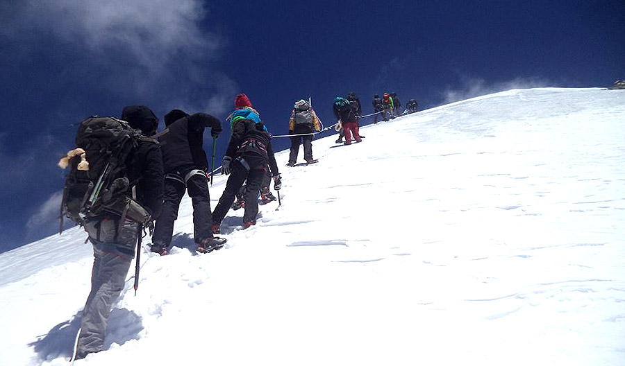
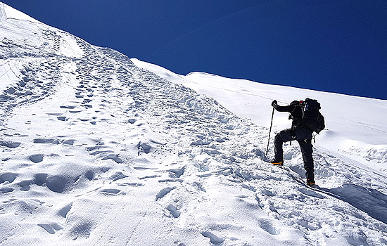
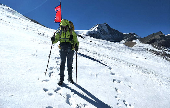
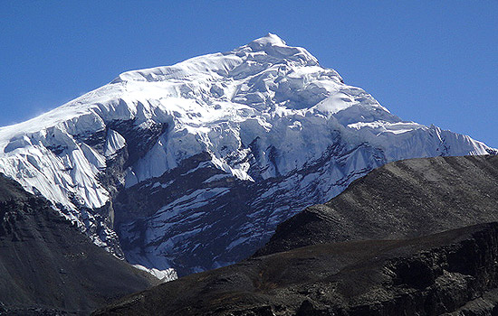
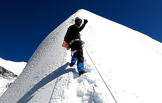
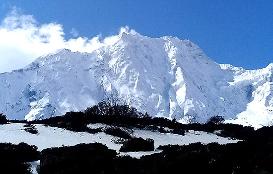
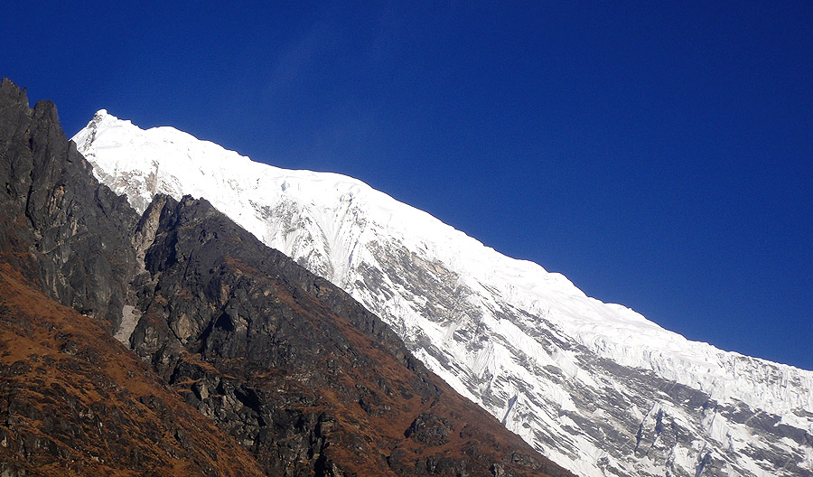
Trek from Ghorepani to Poon Hill (3180m.) to Tadapani (2675m.) which takes about five and half hours. Early morning trip to Poon Hill (3232m.) to enjoy the sunrise view over Mt. Dhaulagiri (8167m.), Tukuche Peak (6920m.), Nilgiri (6940m.), Varaha Shikhar (7847m.), Mt. Annapurna I (8091m.), Annapurna South (7219m.), Annapurna III (7855m.), Machhapuchhare (6993m.), Annapurna IV (7525m.), Annapurna II (7937m.), Lamjung Himal (6931m.) and other numerous snowcapped mountain peaks. After breakfast trek Ghorepani to Tadapani (2650 m.). After walking for almost one and half hour you reach Gurung Hill which has the splendid mountain views as Poon Hill. From here you follow small forests with rhododendron, bamboos until you reach Deurali. The trail goes steeply down through deep forests all the way to Banthati. It takes one hour from here to reach Tadapanil After breakfast trek from Ghorepani to Tadapani (2731m.) through the deep forests of rhododendrons, bamboos and oaks. En route, you frequently see waterfalls, rocks, wild animals, local birds and green scenarios. Tadapani is a small village surrounded by beautiful forests which grants you a magnificent view of Annapurna South, Hiunchuli, Fishtail, and Annapurna II and so on.

Food
BLD
Accomodation
Lodge
Elevation
2675

Trek from Tadapani (2675m.) to Ghandruk (1950m.) and it takes about three hours. It is very easy trek by descending gently all the way through rhododendron, oak and other kinds of dense forests. You could hear different kinds of birds chirping on the way. This is one of the popular destinations for the birds’ lovers. Ghandruk is a big Gurung village. There is a handicraft centre and Gurung museum. From this village you could see good views of Annapurna South, Hiunchuli, Gangapurna (7455m.), Annapurna III (7755m.) and Fishtail.

Food
BLD
Accomodation
Lodge
Elevation
1950

Trek from Ghandruk to Chhomrong (2040 m.) which takes approximately four hours. At the beginning of the day, you could ascend gently for an hour up to Ghandrukkot (2100m.) and descend steeply to the Kimron Khola (1700m.). Immediately, ascend steeply and walk at a level for an hour and still ascend gently to the final camp. Chhumrung is a gateway to Annapurna Sanctuary trek and inhabited by Gurung, one of the major Ethnic group of Nepal .

Food
BLD
Accomodation
Lodge
Elevation
2040

Trek from Chhomrong to Bamboo (2340m.) and it takes about five hours. Leaving Chhomrong, the trail descends on a stone staircase and crosses the Chhomrong Khola on a swaying suspension bridge, then climbs out of the side valley. High above the Modi Khola on its west bank, the trail passes through the tiny settlement of Tilicho in forests of bamboo, rhododendron and oak. Climbing further on a rocky trail (beware of the stinging nettles) you reach three hotels at Sinuwa, at 2350m. Climb in rhododendron forests to Kuldi, at 2520m. This was once a British sheep breeding project; now the stone houses are an ACAP visitor centre and check post. In winter, it’s common to find snow anywhere from this point on. Descend a long, steep stone staircase into deep bamboo and rhododendron forests. It is then a short distance on a muddy trail to Bamboo Lodge (2340m.).

Food
BLD
Accomodation
Lodge
Elevation
2340

Trek from Bamboo to Deurali (3230m.) which takes about five hours. You trek gently ascend through bamboo forests with varieties of rhododendron and oak trees. The first town you reach is Dovan (2630m.) where there are few lodges and camp sites. Now you pass through muddy trail which traverses high above the river. There is debris of avalanches except during winter season. After short trek, you reach at Himalayan Hotel (2900m.), the town named after the Himalayan Hotel. Beyond it, the trail is steeply ascent up to Hinko Cave (3160m.), this named as a huge overhanging rock provides some protection against rain and avalanches. It takes approximately twenty minutes through normally ascent path to reach Deorali (3230m.)

Food
BLD
Accomodation
Lodge
Elevation
3230

Trek from Deurali to Annapurna Base Camp (4170 m.) via Machhapuchhare Base Camp (3820m.) and it takes about four hours. From here, the valley widens and becomes less steep and you can see the gates to the sanctuary. The trail is less steep. As the trail continues into the sanctuary, it crosses two avalanche tracks on a narrow trail that hurdles up against the cliffs. After short trek you will be at Bagar (3310m.), a meadow and some abandoned hotels. The normal trail follows the left side of the valley. Now the trail appears gently ascent until you reach Machhapuchhare Base Camp (3820m.). Here you find almost 6 to 7 lodges. This is one of the places, where you can enjoy the view of Mount Hiunchuli (6441m.), Annapurna South (7229m.), Annapurna I (8091m.), Annapurna III (7555m.), Gangapurna (7454m.) and Machhapuchhare or Fish Tail (6997m.). The path follows through alpine meadow and after some distance your trails go gently up. After a short trek, you begin to approach Annapurna Base Camp (4170m.). From here, you can see the views of several peaks at 360 degree.

Food
BLD
Accomodation
Lodge
Elevation
4170

Rest at Annapurna Base Camp (4,100). This is an acclimatization day for the preparation of summit.

Food
BLD
Accomodation
Lodge
Elevation
4100

Trek from Annapurna Base Camp to Ten Peak Base Camp which takes about five hours. You cross Annapurna glacier to follow the steep ascent trail all the way to Ten Peak Base Camp. On the way you can enjoy the panoramic views of Hiunchuli (6441m.), Annapurna South (7229m.), Annapurna I (8091m.), Fishtail Mountain , Barahashikhar Mountain and many others.

Food
BLD
Accomodation
camp
Elevation
4800

Trek from Ten Peak Base Camp (4,800m.) to High Camp (5,200m.) and it takes about five hours. The trail is steep ascent all the way to High Camp. This day you can enjoy the panoramic views of Hiunchuli (6441m.), Annapurna South (7229m.), Annapurna I (8091m.), Fishtail Mountain , Barahashikhar Mountain and many others.

Food
BLD
Accomodation
camp
Elevation
5200

Rest at Ten Peak High Camp. This is an acclimatization day for the preparation of Singu Chuli summit.

Food
BLD
Accomodation
camp
Elevation
5200

Climbing High Camp to Singu Chuli Camp I (5,500m.). The trail is rocky and covered by icy glacier. The views to be enjoyed are of Hiunchuli (6441m.), Annapurna South (7229m.), Annapurna I (8091m.), Fishtail Mountain , Barahashikhar Mountain and many others.

Food
BLD
Accomodation
camp
Elevation
5500

Singu Chuli Camp I to Singu Chuli Camp II (5,800) which takes about five hours

Food
BLD
Accomodation
camp
Elevation
5800

Singu Chuli Camp II to summit (6,501m) and back to Singu Chuli Camp

Food
BLD
Accomodation
camp
Elevation
6501

Singu Chuli Camp II to Ten Peak Base Camp which takes about six hours. This day you descend all the way to Ten Peak Base Camp.

Food
BLD
Accomodation
camp
Elevation
4800

Trek from Ten Peak Base Camp to Macchapucchre Base Camp and it takes about five hours. You descend all the way to Annapurna Glacier and after crossing it the trail is gradual down all the way to Macchapucchre Base Camp.

Food
BLD
Accomodation
camp

Trek from Macchapucchre Base Camp to Sinuwa and it takes about six hours. The trail moves downhill until you reach Bamboo. After Bamboo, the trail goes steeply up to the Kuldi Ghar and now the trail is quite flat until you reach Sinuwa. There are few tea houses at Sinuwa.

Food
BLD
Accomodation
camp

Trek from Sinuwa to Jhinudanda (1750m.) which takes about four hours.

You trek gradually descend to the Chhumrong Khola and you have to follow stone staircase for almost an hour to reach Chhumrong. The last part of the trail is steeply down to Jhinudanda. From the town you should walk down for 20 minutes to reach Hot Spring at the bank of the Modi Khola. You can relax at Hot Spring.

Food
BLD
Accomodation
camp
Elevation
1750

Trek from Jhinudanda to Pothana (1600m.) which takes about five hours. The first part of the trek is descent and then appears through flat land until you reach Himal Pani. Here you find beautiful waterfall. Beyond this town, the trail ascends gently crossing numerous streams and terraces. After short trek, you will be at Landruk (1640m.), a pretty big village inhabited by mixed community of Gurung, Magar and Brahmin as well. Now the trail gently ascends to Tolka (1850m.) and then ascent and level path to Bherikharka. From here, the trail goes steeply up to Deorali (2100m.) with a view of different mountain peaks in panorama. Now the trail gradually descends to Pothana passing through different oak forests. Pothana is a small town resided by Gurung, a ethnic community of Nepal . From here too, you can enjoy the splendid views of various mountain peaks.

Food
BLD
Accomodation
Lodge
Elevation
1600

Trek from Pothana to Dhampus Phedi and it takes approximately three hours and drive from Dhampus Phedi to Pokhara by car. The trail is gently descent up to Dhampus, a village mainly inhabited by Gurung. Now you trek through flat land for some distance and steeply descend to Dhampus Phedi. Now you take vehicle to drive from Dhampus Phedi to Pokhara.

Food
BLD
Accomodation
Hotel
Elevation
900

Drive from Pokhara to Kathmandu by tourist mini bus that takes about seven hours. While driving from Pokhara to Kathmandu, you head up to Damauli,, Dumre, Muglin and Kurintar where the Nepal ‘s first Cable car is operated to reach to Manakamana Temple . En route, you could enjoy the mountain views, green sceneries, rice terrace fields, vegetable fields and people being engaged in their daily life activities. From Naubishe you climb up to Thankot, the gateway to capital city. Or you can fly from Pokhara to Kathmandu and it takes about 25 minutes.

Food
BLD
Accomodation
Hotel
Elevation
1350

What Is Included ?

  • English Speaking guide
  • Porters and other staff
  • Private ground transportation throughout the tour
  • Travel Permit
  • Accommodation in hotels during the tour in 3 star hotel in twin sharing basis, breakfasts.
  • Sighseeing tour
  • Monastries entry fees.

What Is Excluded?

  • Personal expenses
  • Travel Insurance
  • Nepal re-entry visa
  • Flights wherever applicable
  • Emergency evacuation by Helicopter
  • Alternative transportation in case of heavy rain, landslide, strike, road blockade etc.

Singu Chuli Peak Climbing Altitude Profile

MAKE AN INQUIRY
hiking icon

Checkout Our Packages

Explore More
Chulu East Peak Climbing

$1150 / Person

Nepal Duration: 21 Days

Chulu East Peak Climbing
Lobuche East Peak Climbing

Nepal Duration: 17 Days

Lobuche East Peak Climbing
Yala Peak Climbing

Nepal Duration: 14 Days

Yala Peak Climbing
Pisang Peak Climbing

Nepal Duration: 15 Days

Pisang Peak Climbing
Mera Peak Climbing

Nepal Duration: 17 Days

Mera Peak Climbing
Dhampus (Thapa) Peak Climbing

$2780 / Person

Nepal Duration: 20 Days

Dhampus (Thapa) Peak Climbing
Chulu West Peak Climbing

Nepal Duration: 20 Days

Chulu West Peak Climbing
Island Peak (Imja Tse) Climbing

Nepal Duration: 17 Days

Island Peak (Imja Tse) Climbing
Larkya Peak Climbing

Nepal Duration: 20 Days

Larkya Peak Climbing
Naya Kanga Peak Climbing

Nepal Duration: 16 Days

Naya Kanga Peak Climbing
Saribung Peak Climbing

Nepal Duration: 26 Days

Saribung Peak Climbing

We are Member of

  • partner
  • partner
  • partner
  • partner
  • partner

We accept

  • payment
  • payment
  • payment
  • payment

Find & Follow Us on

  • tripadvisor

© 2011 - 2024 All rights reserved. Nepal Environmental Treks & Expedition (P.) Ltd.